
Camino de Santiago (Camino Francés) Map Poster
Over the Pyrenees, across the Meseta and into Galicia: this Camino de Santiago map poster follows the 780 km (485 mi) Camino Francés from Saint-Jean-Pied-de-Port to the cathedral in Santiago de Compostela.
Walking the Camino de Santiago
The Camino de Santiago's most-walked route, the Camino Francés, is a 780 km (485 mi) pilgrimage across northern Spain, from Saint-Jean-Pied-de-Port in the French Basque Country to the cathedral of Santiago de Compostela in Galicia. It climbs over the Pyrenees to Roncesvalles on the first day, then runs west through Pamplona, the vineyards of La Rioja, Burgos and its Gothic cathedral, the long, flat Meseta and León, before the green, misty hills of Galicia lead down to the Plaza del Obradoiro.
Most pilgrims walk it in 30 to 35 days, with about 13,000 m (42,700 ft) of climbing spread across the whole route. The first day is the hardest, gaining more than 1,200 m (3,900 ft) over the Pyrenees, and the highest ground comes near the Cruz de Ferro at about 1,500 m (4,900 ft), where pilgrims leave a stone carried from home. Nights are spent in albergues, the pilgrim hostels found in almost every town, with a credencial stamped along the way.
People have walked to Santiago since the Middle Ages, following scallop shells and, today, painted yellow arrows, and the route has been a UNESCO World Heritage Site since 1993. In 2025 more than 530,000 pilgrims collected a Compostela in Santiago. Follow the yellow arrows one more time, this time by reliving your adventure with a Camino de Santiago map poster.
What adventurers said about this trail
Customer Reviews
Great item..
Free shipping is way too slow..
I have bought both a VF map of my route from Canterbury to Rome and a Camino Frances of my route from SJPDP to Santiago and am delighted with them both. Great qualit and great service. I highly recommend
Poster took a while to get to me, but is just as described and printed on high quality paper. Overall, very happy with my purchase and would recommend.
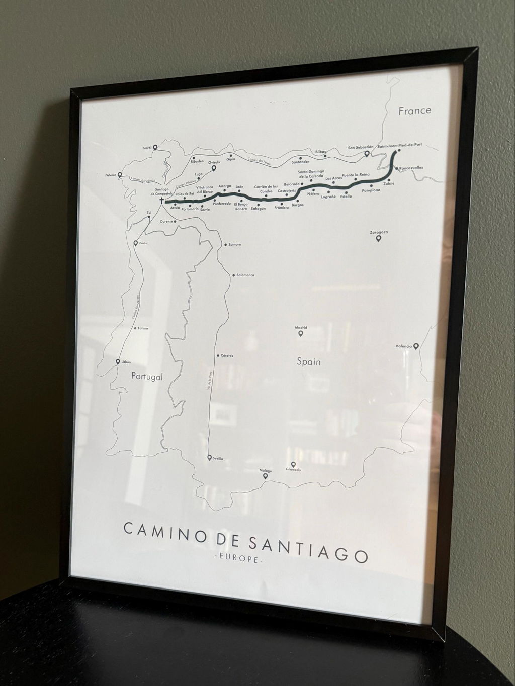
I'm in love with this poster!
Very minimalistic. I was not happy with the lack of detail the map.
People who walked this also liked
See more trails →


